6005 Oakdale Road, Baxter, MN 56425
For Sale $299,000.00
PENDING!
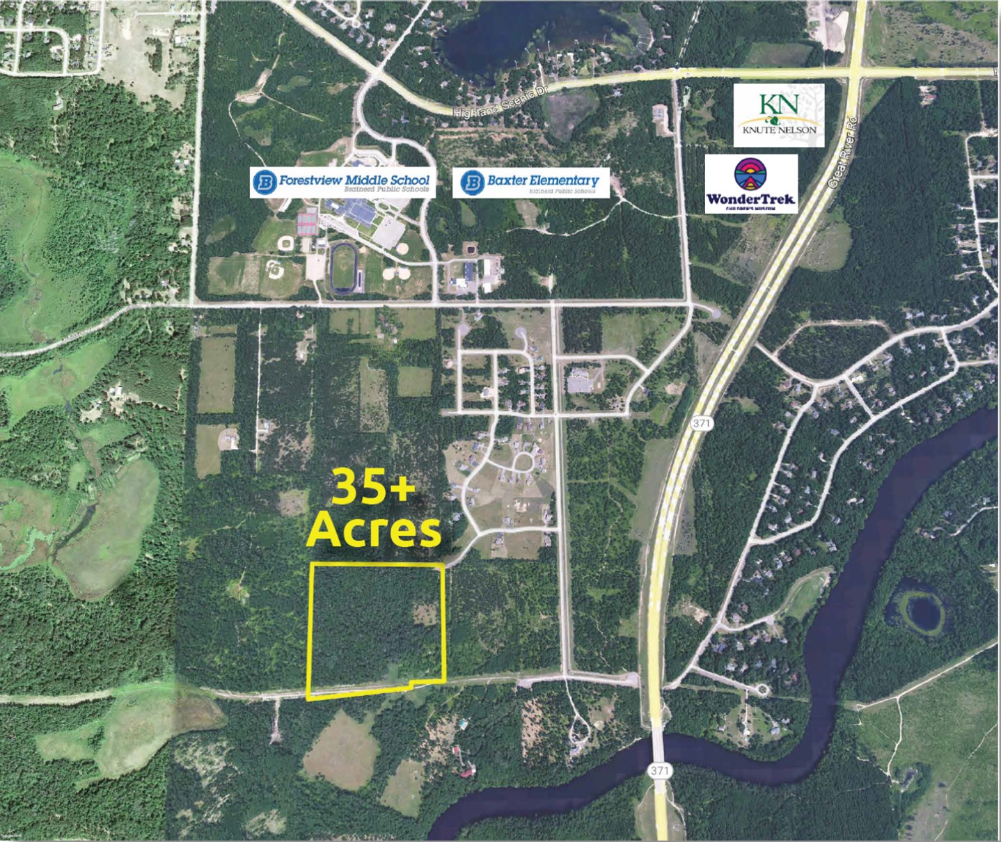
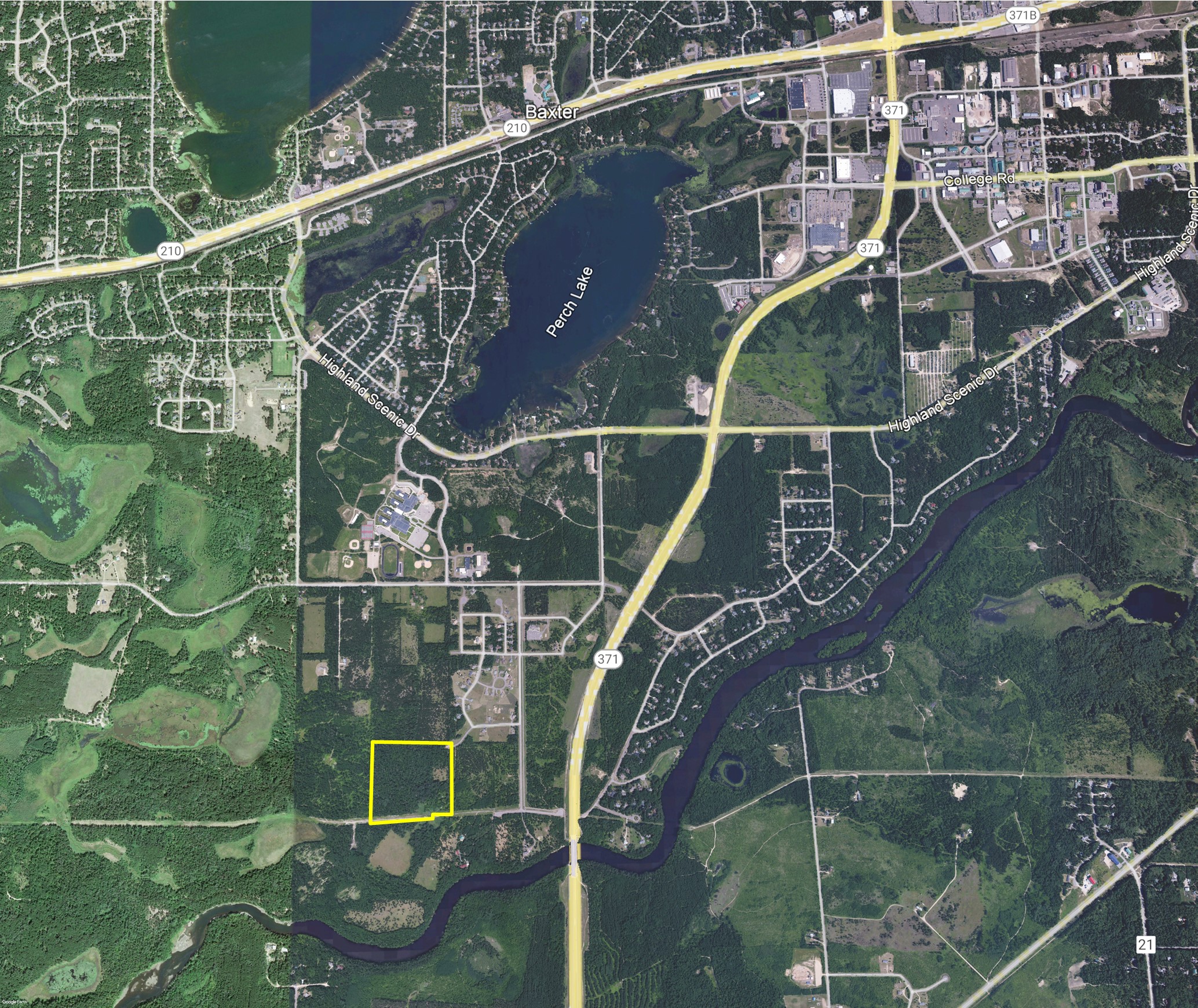
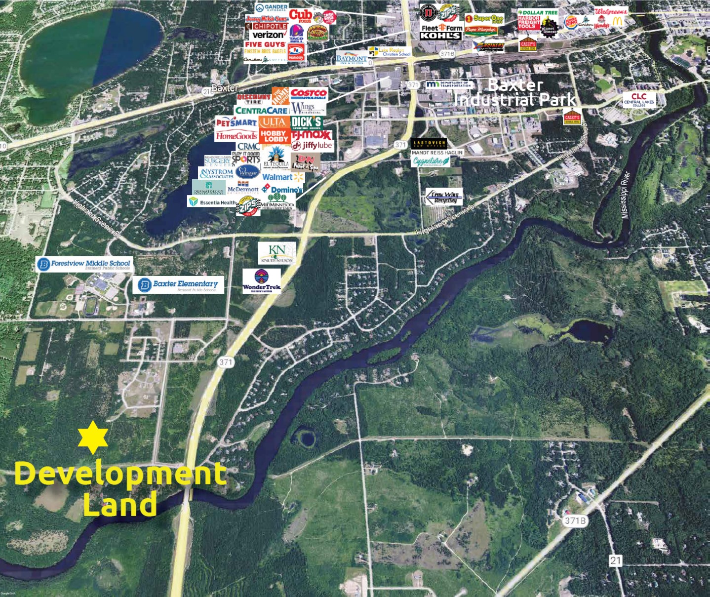
Sizable residential development plot spanning over 35 acres, located in Baxter, just south of Forestview Middle School. This property offers an ideal investment opportunity for developers within the Brainerd/Baxter Area. Conveniently situated near schools, places of worship, retail outlets, restaurants, entertainment venues, and recreational facilities.
- Purchase Price: $299,000.00
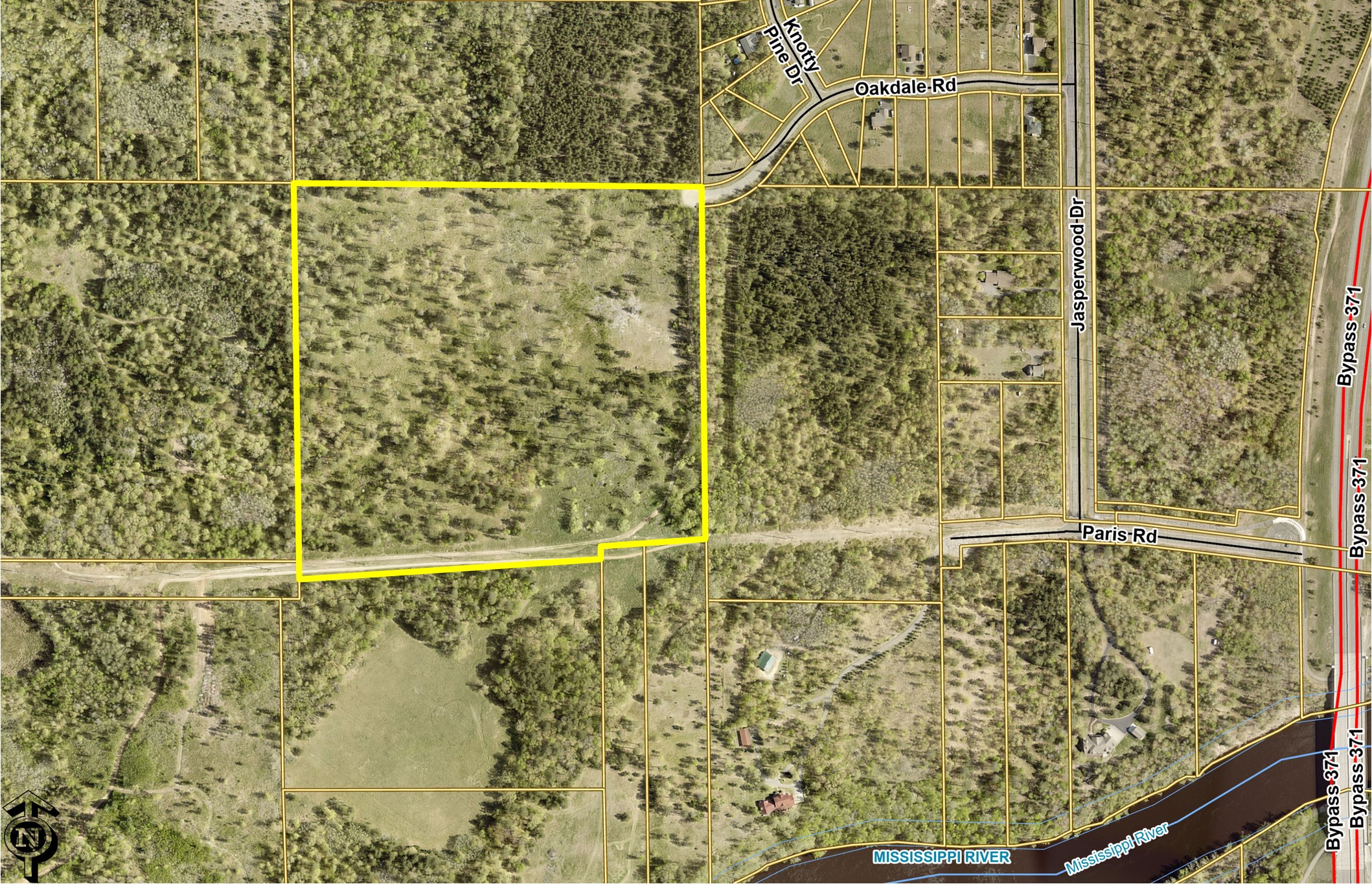
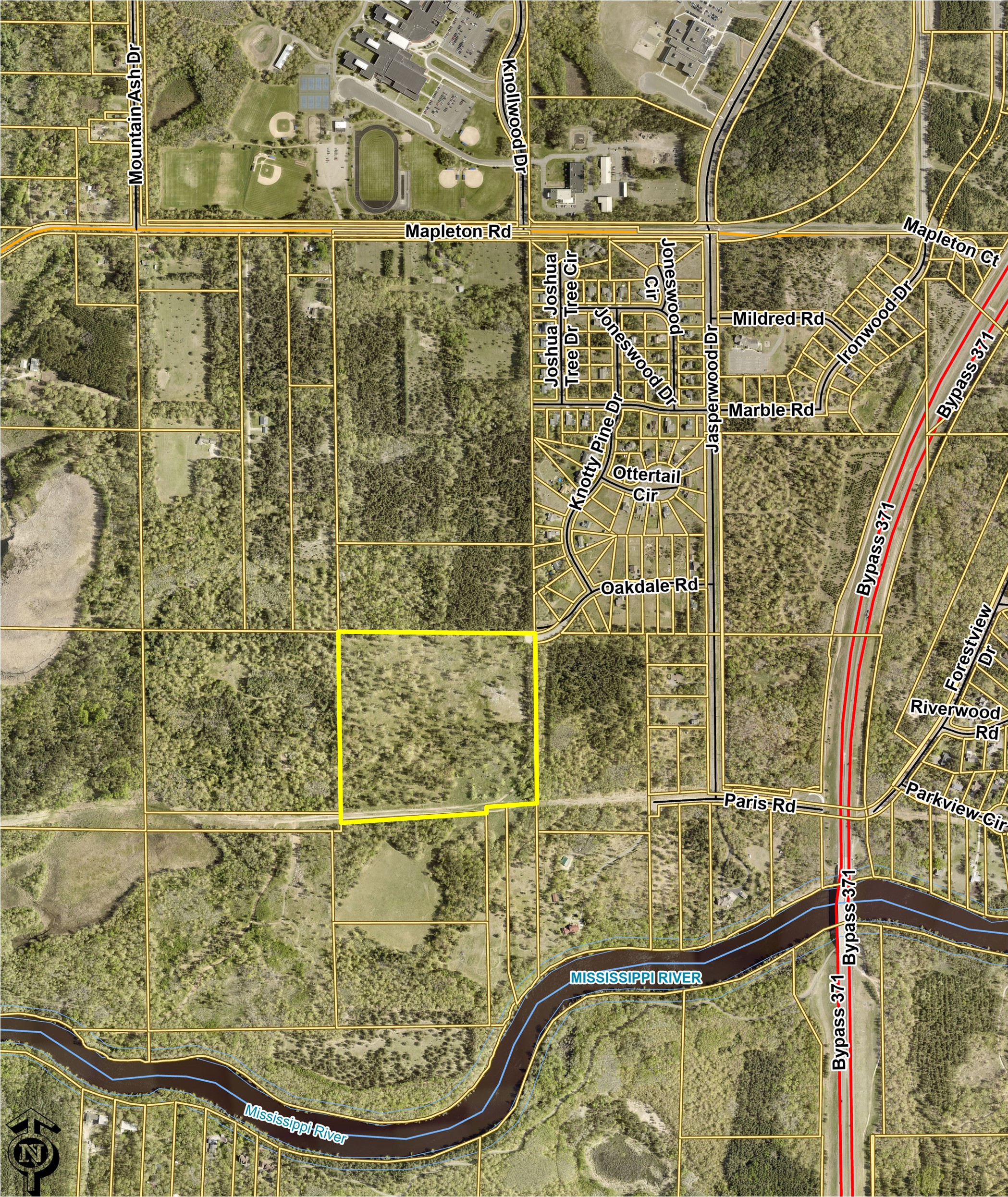
- Directions: From Hwy 210/371 intersection in Baxter - South on Hwy 371 - West on Highland Scenic Drive (CR 48) - South on Ironwood Drive S - South on Jasperwood Drive - West on Oakdale Road - Property’s NE corner is at the end of the road
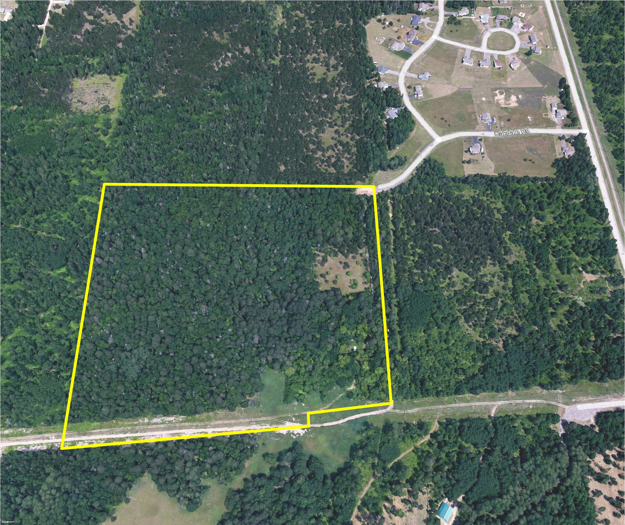
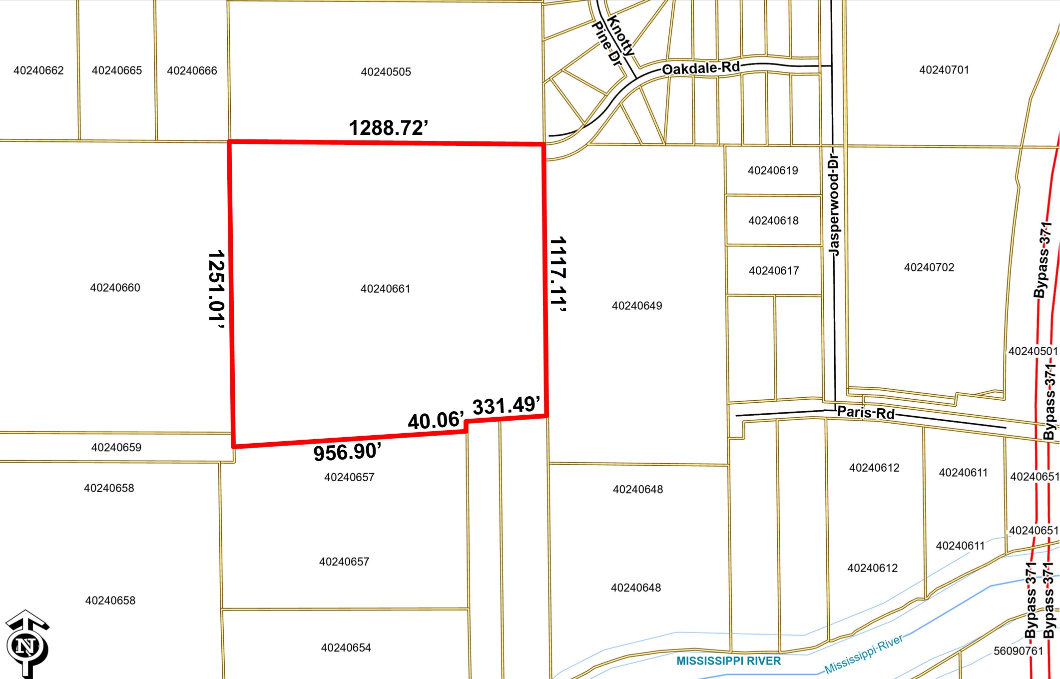
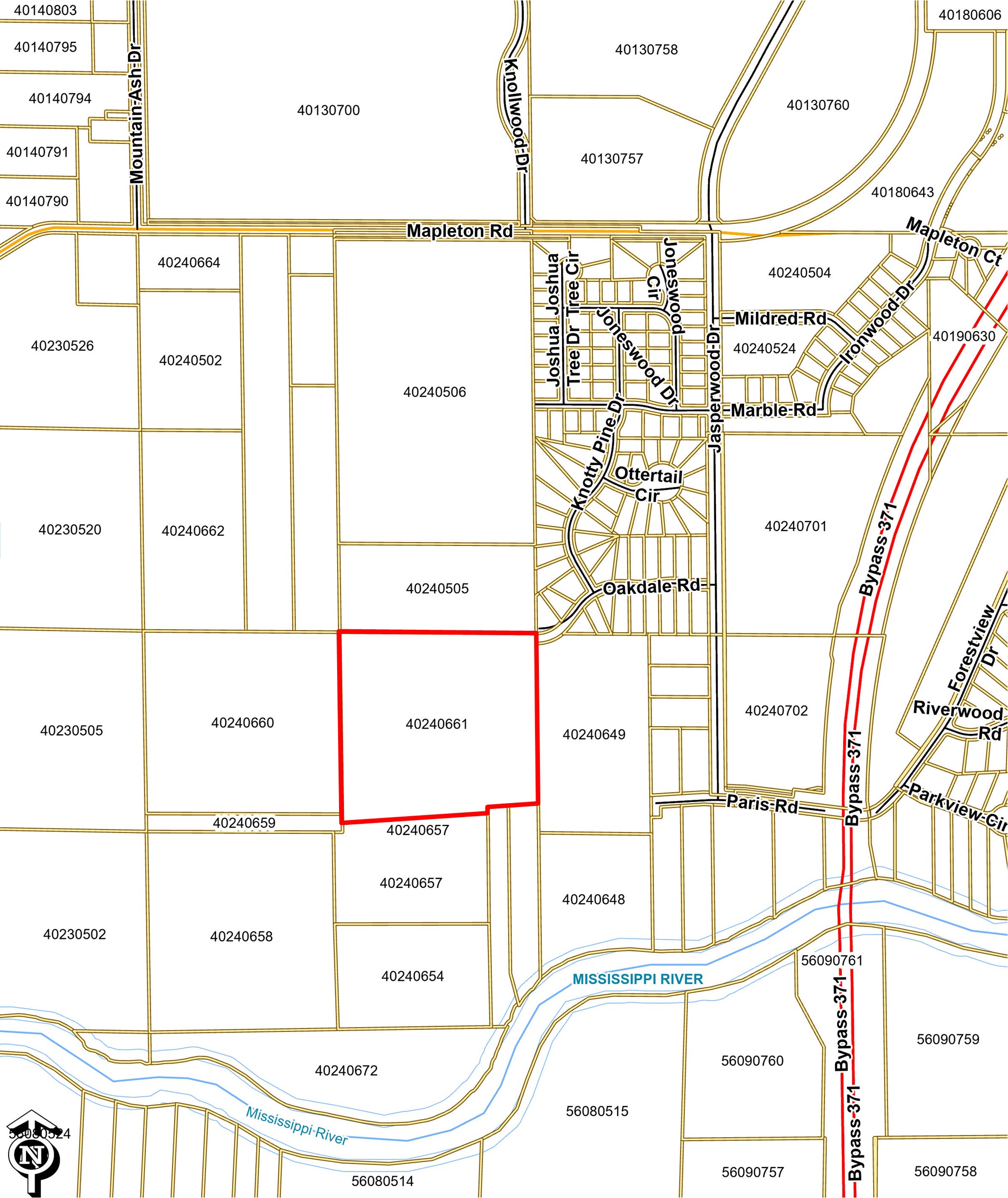
- Lot Size (Sq. Ft): 1,536,797
- Lot Size (Acres): 35.28
- Lot Dimensions: 1,288.72’ x 1,117.11’ x 331.49’ x 40.06’ x 956.9’x 1,251.01’
- Road Frontage: NE Corner of Property is at the end of Oakdale Road
- Property Tax Year: 2025
- Annual Property Tax: $888.00
- Water: City Hook-Up is in Oakdale Road
- Sewer: City Hook-Up is in Oakdale Road
- Neighboring Businesses: Located close to Forestview Middle School, Baxter Elementary School, Knute Nelson Assisted Living, plus several churches, parks & trails. Nearby commercial businesses include Essentia Health Baxter, Surgery Center, Nystrom & Associates, McDermott Orthodontist CRMC, Walmart, MidMN Federal Credit Union, Riverstone Professional Center, Northwoods Plaza, El Tequila, Ulta, PetSmart, TJ Maxx, Dick’s, Costco, Home Depot, Centra Care plus numerous others.
- Traffic Counts: 2,022 (2021) on Mapleton Rd, 7,309 (2022) on Knollwood Dr, 3,840 (2023) - 4,027 (2023) on Highland Scenic Dr (CR 48) and 13,804 (2024) on Hwy 371
- MLS #: 7014740
- CC File #: 1743
- Zoning: R1-Low Density Residential
- PID#: 40240661
- Legal Description: That part of the NE 1/4 of SW 1/4, which lies N’ly of the following desc line; Comm at the NE corner of said NESW, then S 00 Deg 41 Min 28 Sec E, bearing based on the City of Baxter coordinate database NAD 83/88, 1117.11 ft along the E line of said NESW to the point of beg of the line to be desc, then S 86 Deg 11 Min 59 Sec W 331.49 ft, then S 00 Deg 41 Min 28 Sec E 40.06 ft, then S86 Deg 11 Min 59 Sec W 956.90 ft to the W line of said NESW and said line there terminating. Subject to an easement of record.